
2018 Adventures
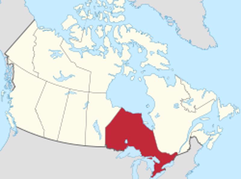
Regina to Dryden Travel Distance: 935 km
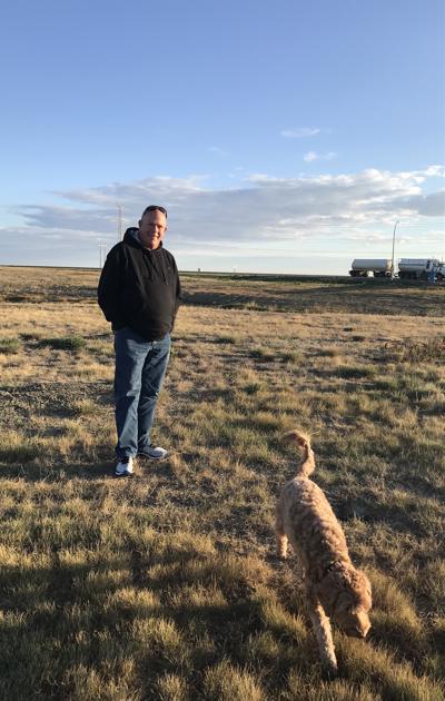
We had a wonderful time in Regina catching up with everyone last night. Early to bed and early to rise to continue on in our journey to Dryden.
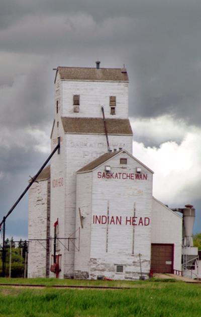
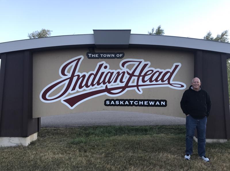
As we headed out of Regina and headed east, we stopped briefly in Indian Head. Indian Head is located in the heart of Saskatchewan's richest farmland, and beside the Canadian Pacific Railway's main east-west line. Those two facts have had a great influence on the
brenda stanger
104 chapters
16 Apr 2020
On the Road to Ontario
Regina to Dryden
Regina to Dryden Travel Distance: 935 km
We had a wonderful time in Regina catching up with everyone last night. Early to bed and early to rise to continue on in our journey to Dryden.
As we headed out of Regina and headed east, we stopped briefly in Indian Head. Indian Head is located in the heart of Saskatchewan's richest farmland, and beside the Canadian Pacific Railway's main east-west line. Those two facts have had a great influence on the
history and development of the community.
A few settlers attracted by the fertile land had already built homesteads when the 53,000-acre Bell Farm began operations in 1882, a few months before railway tracks were laid through the district. The Bell Farm built a grain elevator, flourmill and hotel in the new town.
Many of the town's streets are named after the farm's original investors, and it also left its mark on how the streets are laid out. Where most prairie towns are laid out on a grid, with streets running parallel to, and perpendicular to the railway line, the streets in Indian Head run at an angle, making a shorter trip from town to the headquarters of the Bell Farm to the northwest.
Indian Head was incorporated as a town in 1902, when it was one of the world's largest initial shipping points for wheat. Meetings held here led to the formation of the Territorial Grain Growers' Association, an early advocacy group for farmers.
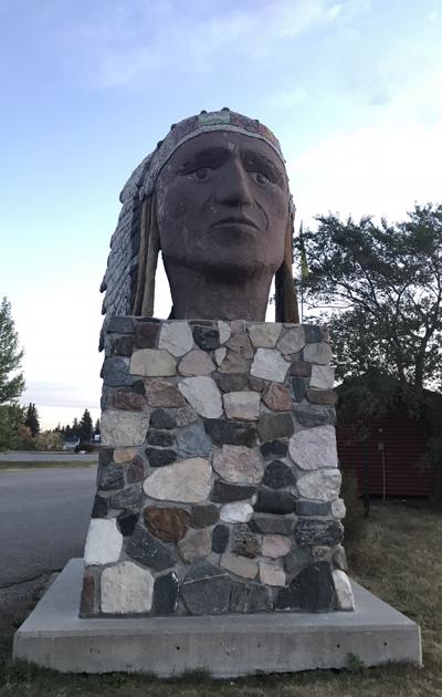
There are several versions of how Indian Head got its memorable name. Some are more believable than others. One version that sounds plausible comes from information at the Indian Head Museum and from Chief Albert Eashappie's account recorded in the Indian Head and District history book.
Many First Nations people were stricken by diseases like smallpox, which were introduced by fur traders who traveled through this area. Local First Nations people used the hills south of the current town site as their burial grounds, but many bodies were not buried at all, so great was the fear of contracting the disease.
Over the years the First Nations people came to call the burial ground the Many Skeletons Hills or Many Skulls Hills. The new settlers who came to the area referred to them as the Indian Head Hills.
When the Canadian Pacific Railway laid track through this area in 1882 the new settlement where the railway station was built needed a name. The townspeople wanted the name Indian Head Hills, and offered
the First Nations people a camping ground near the town in exchange for the name.
The town became Indian Head, without "Hills", perhaps because it sits on fertile, relatively flat, plains.
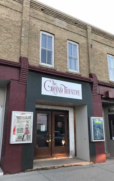
A stop in Indian Head is not complete with a stop next to the town's large "Indian Head" by the tourist centre and a glimpse at the grain silos still in operation. We continued to stroll down memory lane and to the old Gary Theatre building. It has been renamed but the building still stands and plays second run movies. It is there where the Williams family members all played a critical role in helping the area residents enjoy their time at the movies. Rick has many great memories as a small child in Indian Head. The community is very quaint and seems like a great place to raise a family.
Well.. back on the road. We shared the driving on the way to Dryden as we were both up at the crack of dawn and have the nearly the distance to Vancouver to drive.
Dryden is where the outdoor beauty of Northwestern Ontario meets the bright lights of city life. With a long history, Dryden is home to people of many different cultures and backgrounds. In 1897, the village was officially named Dryden after Honourable John
Dryden. By then, the village had grown to about 24 homes and stores, a working sawmill, more than a dozen families settled with homesteads, and more were on their way.
Pulp and Paper came to the town in 1910. Today, its main industries are agriculture, tourism and mining. Paper/pulp industries in Dryden were a major contributor in its local economy. In 2008 the mill ceased production of fine paper as the second of two paper machines was shut down. The town came onto the national consciousness in the early 1970s when natives at the community of Grassy Narrows became sick with Minamata disease (mercury poisoning). Investigation determined that a chloralkali plant located at the Dryden mill was the source of the mercury in the Wabigoon and English rivers. The pulp mill has since shut down and the area continues to work on improving the water table and mercury levels of the soil.
With Dryden being only an overnight stop we didn't have much time to checkout the sights. A quick bite to eat and settled in for the night. Tomorrow we continue on in our journey to ThunderBay.
1.
Year of Travel
2.
Sosua - Dominican Republic
3.
Our Adventures So Far...
4.
Beach Life
5.
Our Favourite Restaurants in Sosua
6.
Fun with Friends
7.
Sosua Continued
8.
Sun, Surf and Sand
9.
Samana Peninsula
10.
Sosua Highlights
11.
USA Road Trip
12.
Texas
13.
Texas
14.
Louisiana - NOLA
15.
Louisiana - NOLA
16.
Louisiana - NOLA
17.
Alabama
18.
Alabama to Tennesse
19.
Tennesse - Nashville
20.
Tennesse - Nashville
21.
Tennesse - Nashville
22.
Tennesse - Memphis
23.
Tennesse - Memphis
24.
Tennesse - Memphis
25.
Summer at Home
26.
Westcoast Adventures
27.
Europe
28.
Europe - Budapest
29.
Europe - Budapest
30.
Europe - Vienna
31.
Europe - Vienna
32.
Europe - Vienna
33.
Europe - Prague
34.
Europe - Prague
35.
Europe - Prague
36.
Europe - Berlin
37.
Europe - Berlin
38.
Europe - Berlin
39.
Europe - Salzburg
40.
Europe - Salzburg
41.
Europe - Salzburg
42.
Europe - Salzburg
43.
Europe - Salzburg
44.
Europe - Innsbruck
45.
Europe - Innsbruck
46.
Europe - Bad Ragaz
47.
Europe - Bad Ragaz
48.
Europe - Lindau
49.
Europe - Lindau
50.
Europe - Fussen
51.
Europe - Fussen
52.
Europe - Freising and Munich
53.
San Francisco
54.
San Francisco
55.
San Francisco
56.
San Francisco
57.
San Francisco
58.
San Francisco
59.
Canada Road Trip
60.
On the Road to Ontario
61.
Ontario - Thunderbay
62.
Ontario - Thunderbay
63.
Ontario - Thunderbay
64.
Ontario - Toronto
65.
Ontario - Ottawa
66.
Ontario - Ottawa
67.
Quebec - Montreal
68.
Quebec - Montreal
69.
Quebec - Montreal
70.
Quebec - Quebec City
71.
Quebec - Quebec City
72.
Quebec - Sainte Flavie
73.
New Brunswick - Bathurst
74.
New Brunswick - Shediac
75.
New Brunswick - Shediac
76.
Prince Edward Island - Charlottetown
77.
Prince Edward Island - Road trip
78.
Prince Edward Island - Charlottetown
79.
Prince Edward Island - More exploration
80.
Nova Scotia - Halifax
81.
Nova Scotia - Halifax
82.
Nova Scotia - Halifax
83.
Nova Scotia - Sydney
84.
Newfoundland - Channel-Port
85.
Newfoundland - Rocky Harbour
86.
Newfoundland - Rocky Harbour
87.
Newfoundland - St. John's
88.
Newfoundland - St. John's
89.
Newfoundland - St. John's
90.
Newfoundland - St. John's
91.
Newfoundland - St. John's
92.
Newfoundland - Travelling
93.
Nova Scotia - Sydney
94.
New Brunswick - Saint John
95.
Maine - Portland
96.
Massachessets - Cape Cod via Boston
97.
Massachusetts - Cape Cod
98.
Massachusetts - Cape Cod
99.
Pennsylvania - Clearfield
100.
Illinois - Chicago
101.
Illinois - Chicago
102.
Illinois - Chicago
103.
Heading Home
104.
Our Year at a Glance
Share your travel adventures like this!
Create your own travel blog in one step
Share with friends and family to follow your journey
Easy set up, no technical knowledge needed and unlimited storage!
© 2025 Travel Diaries. All rights reserved.