
Now For Something Completely Different
14 - 16 June 2020
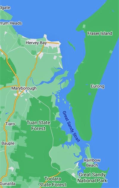
At last today is the day that we will be crossing the “Wide Bay Bar”. I say this in parentheses as this is how John pronounces it – like a long held aspiration, something sacred, his personal Mecca, his Nirvana. The Wide Bay bar is situated between the southern end of Fraser Island and the mainland at Inskip Point and is the entrance to the Great Sandy Straits. It is only 3 nautical miles long but has
Kathryn Hynes
10 chapters
16 Apr 2020
Double Island Point to Tin Can Bay
Double Island Point to Tin Can Bay, Queensland
14 - 16 June 2020
At last today is the day that we will be crossing the “Wide Bay Bar”. I say this in parentheses as this is how John pronounces it – like a long held aspiration, something sacred, his personal Mecca, his Nirvana. The Wide Bay bar is situated between the southern end of Fraser Island and the mainland at Inskip Point and is the entrance to the Great Sandy Straits. It is only 3 nautical miles long but has
claimed many yachts due to the constant movement of the sand bars which shift due to the funnelling nature of tide movement. There are numerous YouTube videos of the often wild crossing.
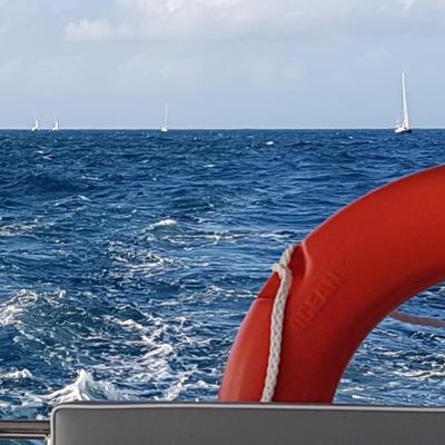
We had to wait for a day when there were light winds and when the tide was flooding into the Great Sandy Straits – this area floods from south to north (of course it is different at the top of Fraser Island). We needed to leave Double Island Point in time to reach the bar at the highest point of the tide. We said good-bye to the beautiful protected lagoon on a slightly overcast and cool day. We left around lunch time which we presumed was the best time as we found ourselves in a procession of about 6 yachts.
Some of our friends saw whales breaching but we were too slow and or far away to catch any. Whilst we motored across the bay John’s excitement was palpable. We contacted the Volunteer Marine Rescue at Tin Can Bay for waypoints – these are latitudinal and longitudinal points through the deepest channel within the bar. Boaties are so fortunate to have the VMR right up the coast. We contact them if we need information about a local area or are going on a long or risky passage. They are all volunteers. Some areas are covered by the Coast Guard who provide a similar service. Hopefully
we’ll never need the “rescue” part of the service.
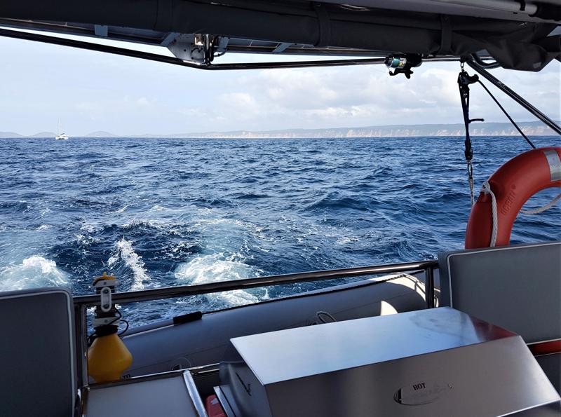
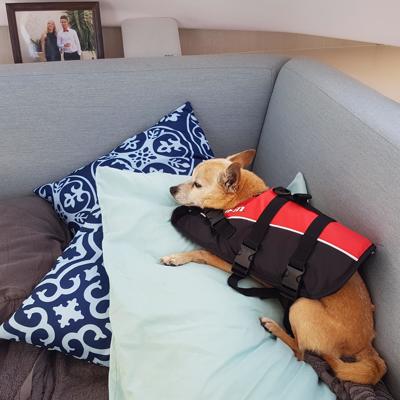
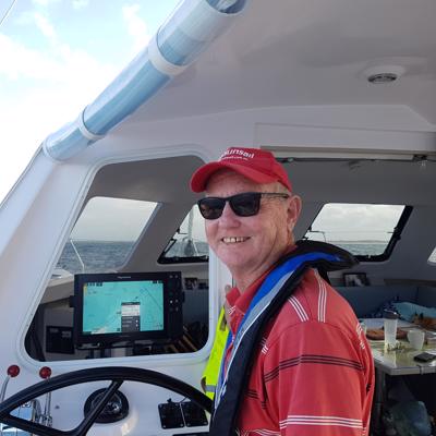
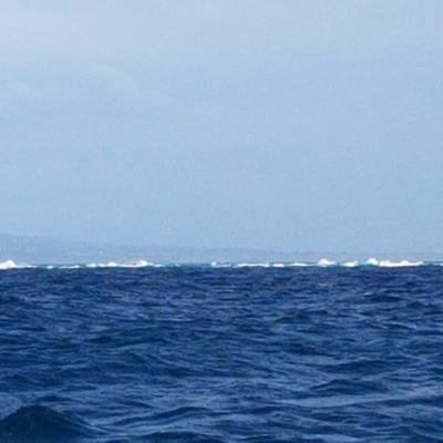
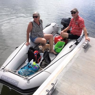
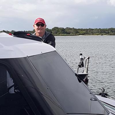
As we entered the actual bar crossing we put on our life jackets. Tallis wasn’t too happy about this and went to sleep in a corner. We wear lifejackets for bar crossings or any rough passage. We followed the waypoints which were really accurate. The waves following us increased to 2 metres but we felt pretty safe. John continually pointed with glee at waves crashing on the surrounding sand bars and shoals “look at that!” He was so happy. Unfortunately none of my photos reflect the magnificence of the occasion. All of the boats in our little flotilla made it safely through and we continued on into Tin Can Bay. Looking back at the charts I see one section is called the “Mad Mile” and I get flashbacks of the “Master’s Mile” that N@ and I "smashed" back in 2018 at the Alice Springs Master's Games.
Tin Can Bay
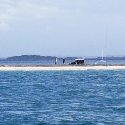
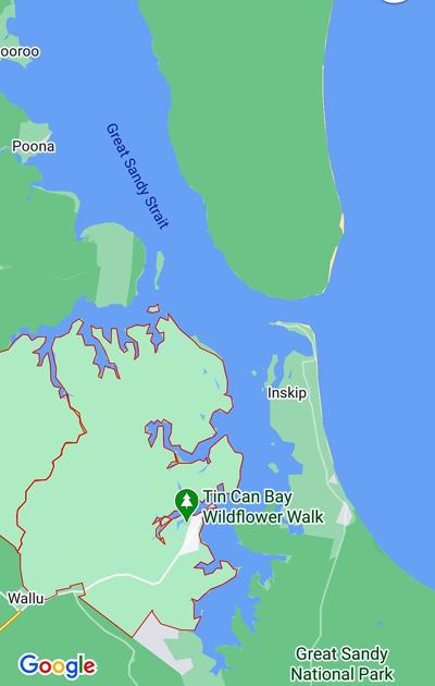
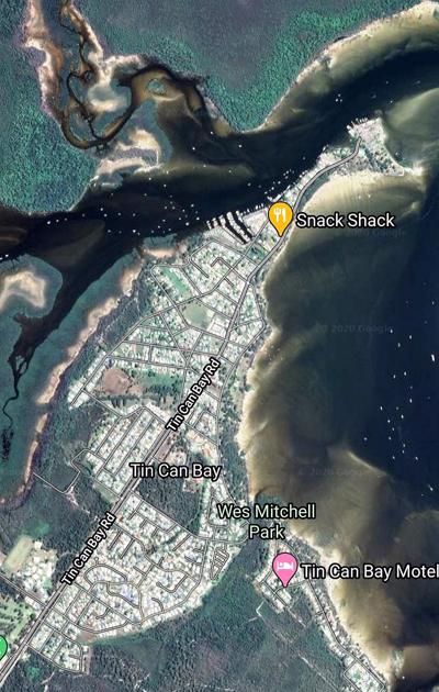
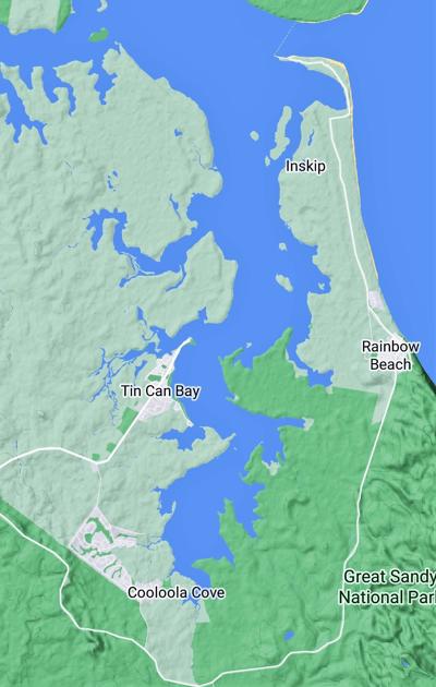
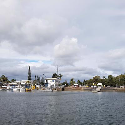
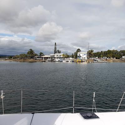
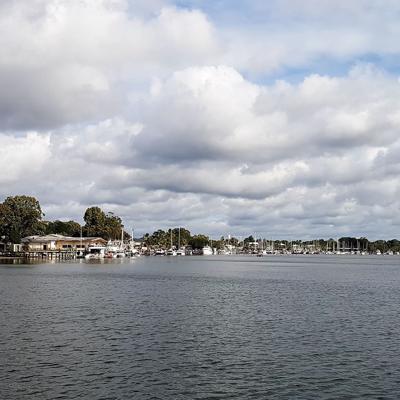
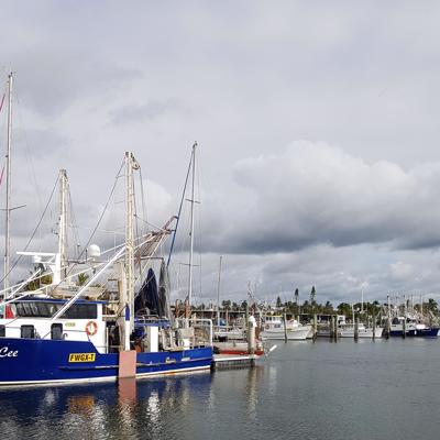
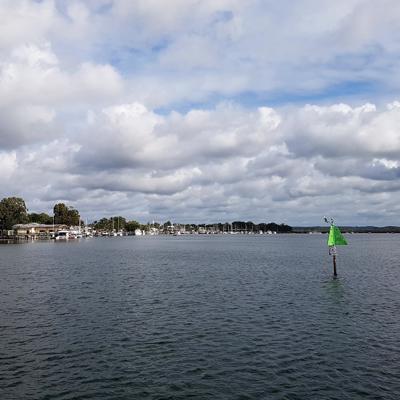
Tin Can Bay is a bay and township south of Inskip Point. We veered left into the inlet and picked our way down the shallow channel. As we got to the small township we decided to anchor on the south-side of town (see the not very clear google image which shows the town,
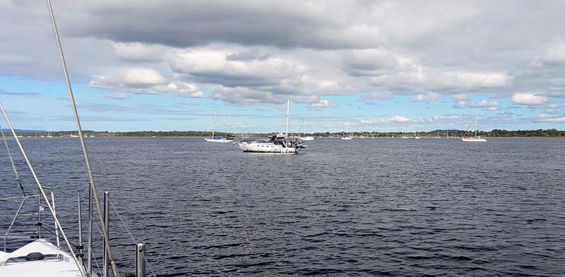
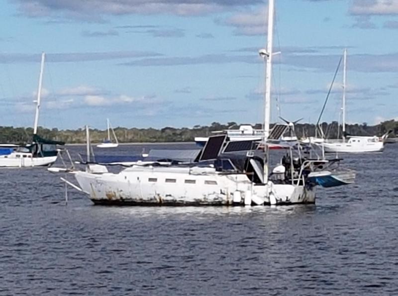
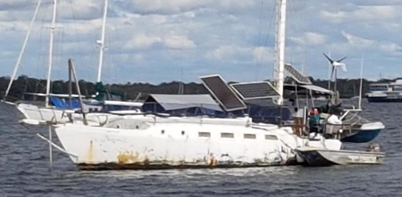
surrounding water and shallows). We passed all sorts of craft anchored here long-term most likely because Tin Can Bay is a large protected waterway. There is even a Manly ferry further into the inlet. Many boats were complete wrecks and we suspect anchor dragging may be an issue as many boats had fenders out on all sides. It is easy to imagine crusty old seadogs drinking rum alone and arguing with their elderly dog companions inside their rusty old vessels.
Hanging out at Tin Can Bay
We continue to find other boaties are very friendly and the occupant on Whoosh, a monohull, gave us a big wave as we went past. Little did we know we would see them many more times on our journey north. Our friends on No Regret anchored much further up the inlet which was smarter now we know where the sandbanks are situated.
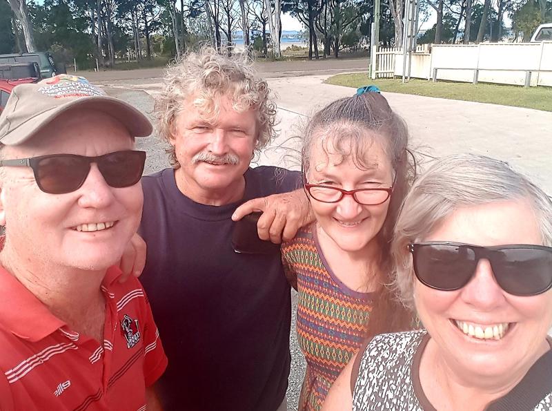
John and I planned to have dinner on board with my friend Lois and her fellow Murray. Lois planned to picnic on shore. However, as it started to rain quite heavily we gathered enough food from their vehicle for a very large feast and took the tender back to Summer Breeze. It was a really wet trip across. We couldn’t, of course, motor directly as this massive low tide sand back popped up and we had to detour quite a long distance around it. Murray’s entrance into the tender was quite jerky and we found out he had just had a hip replacement. I started to laugh quite hysterically in my head visualizing hip dislocation.
Dinner was great (and plentiful). Our visitors were loath to put dry clothes on - that’s all we need – Murray in hospital with dislocated femur AND pneumonia. The evening went really quickly with lots of old memories and new stories. It continued to rain – damn why we
don’t have a rain collector.
Lois and Murray refused the offer of a comfortable bed in a cabin preferring to sleep in the back of their 4WD ute. John ferried our guests back to the public jetty. It wasn’t a straight forward trip as the tender touched the bottom and had to be redirected. It was really dark as well with the cloud cover. I hear that Murray rolled off the boat into a big puddle of water on the jetty. He looked like someone who had a real lot to drink (rolling drunk) when he was in fact moving to protect his hip. John said it was fortunate there were no police around at the time.
The next day we met up with Lois and Murray and had some coffee, picked up some prawns and said goodbye. We spent a pleasant day just hanging out, a bit of lazy fishing and some household chores.
The following day (Adam's birthday) we pulled up anchor and motored up Snapper creek where the marina was located. It was a little nerve-wracking pulling up at the fuel dock as it’s never good to run an expensive boat into a hard jetty. This is spectator sport at its best and many occupants of the moored boats, tradies on shore and assorted randoms came out to watch our skills. Fortunately there
wasn’t much wind or tide and we were able to tie up with some degree of competence.
Whilst John filled up I took Tallis for an investigative walk, with Tallis marking ownership on every post, rock and blade of glass. I picked up some lunch at a small take away and was given the third degree by a local trying to determine my credentials.
On departure we had to spring the boat off the jetty and do a 360? turn without hitting any other boat – some of them looked VERY expensive. Again we disappointed the spectators and made our way up the inlet and into the Great Sandy Straits heading for Kauri Creek where we planned to meet up with our friends on No Regrets.
And now……
We are planning our trip south back to Brisbane and looking at anchorages protected by the northerlies.
Today’s Reflections
What’s good: Talking to friends on the phone
What’s bad: The second state of origin outcome.
What we have learnt: A shoal is an area of shallow water but there are also “shoals” of fish. A loose cluster of fish or other aquatic animal swimming together is a cluster. A “school” is a group of the same fish species swimming together in synchrony. Who would have thought???
Photos:
P 97 Leaving Double Island Point
P 98 Lifejackets - Safety First
P 99 Crossing the Bar
P 100 Maps of Tin Can Bay and the Great Sandy Straits
P 101 Entering Tin Can Bay
P 102 Tin Can Bay Wreck
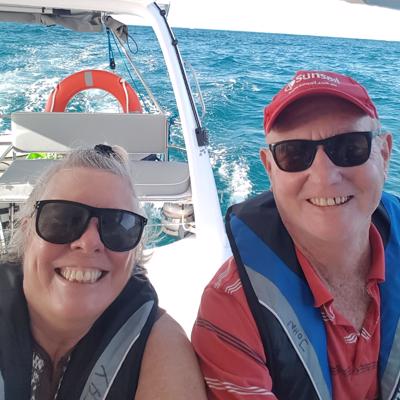
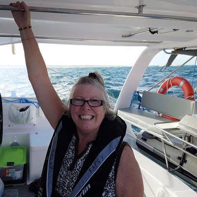
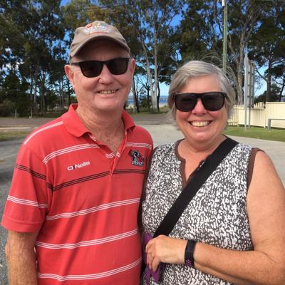
P 103 John, Murray, Lois and Kathy
P 104 Crew returning from shore leave
P 105 Township and Marina from Snapper Creek
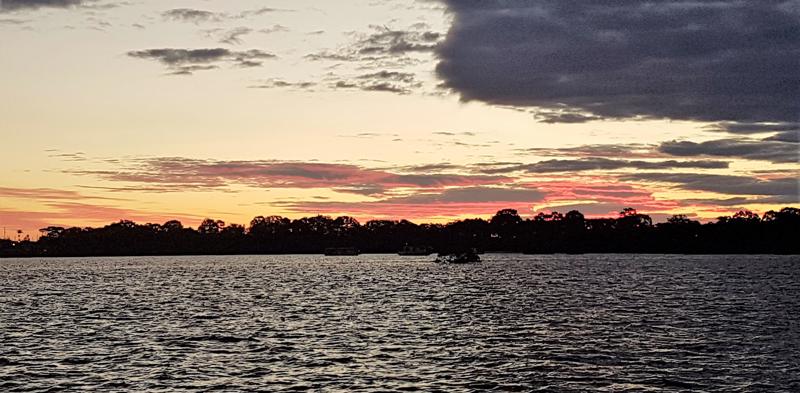
P 106 Sunset over Tin Can Bay
P 107 Memories of Tin Can Bay
Next: Kauri Creek to Scarness, Hervey Bay
Share your travel adventures like this!
Create your own travel blog in one step
Share with friends and family to follow your journey
Easy set up, no technical knowledge needed and unlimited storage!
© 2025 Travel Diaries. All rights reserved.