
Mem's Journey to Scotland
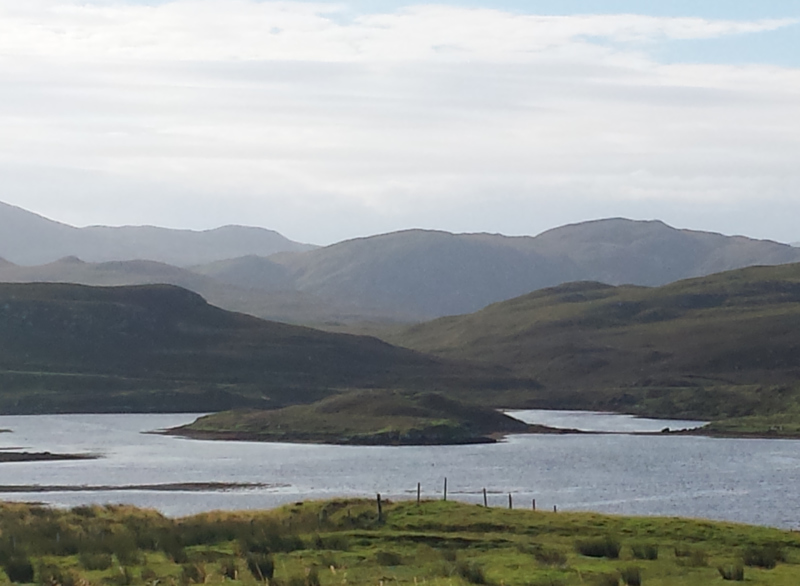
We woke at 3am, and took the ferry from Uig on Skye, to the Isle of Lewis. The ferry crossed calmly, but with the mist we couldn’t see anything, so we settled to snack and snooze instead. We arrived to rain and a chilly 12C. Driving to our campsite, it became apparent that most of the roads on the island are minor roads, with the same twists and turns we’d seen on Skye, only closer to cliff edges. The Outer Hebrides was affected by an Icelandic volcano some centuries ago, which resulted in the striking landscape seen today. There is water everywhere, islands in the middle of lakes, islands in the middle of the ocean, and a sense of being on the edge of the world. We found our campsite after a wrong turn left us in what felt like the
Mem Davis
36 chapters
16 Apr 2020
22nd & 23rd August
August 23, 2016
|
Isles of Skye & Lewis
We woke at 3am, and took the ferry from Uig on Skye, to the Isle of Lewis. The ferry crossed calmly, but with the mist we couldn’t see anything, so we settled to snack and snooze instead. We arrived to rain and a chilly 12C. Driving to our campsite, it became apparent that most of the roads on the island are minor roads, with the same twists and turns we’d seen on Skye, only closer to cliff edges. The Outer Hebrides was affected by an Icelandic volcano some centuries ago, which resulted in the striking landscape seen today. There is water everywhere, islands in the middle of lakes, islands in the middle of the ocean, and a sense of being on the edge of the world. We found our campsite after a wrong turn left us in what felt like the
middle of nowhere. That is, the middle of nowhere with a lovely view. A lovely, elderly woman came out to greet us, and we filled our details in an address book which looked like it had been around a long time. It turns out the campsite is quite popular, but there was only one other camper when we arrived.
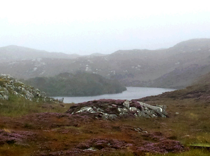
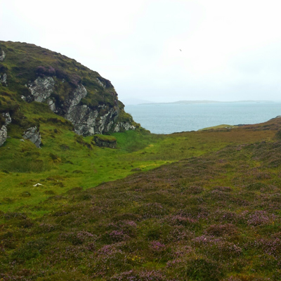
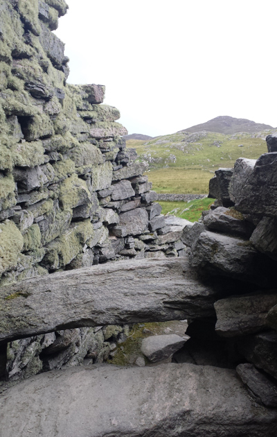
The rain made it hard to see far, but even with the mists, the lake and ocean views were amazing. It’s other-worldly. At low tide, the scattering of islands display layers of stone, from black, to browns, reds, and grassy tops. Each shape is unique, with the coastline and lochs forming organic curves in the water. Harris has few trees. Other than grass, most of the scenery is rockery and shrubs. It has a moon-like feel to it. The land is covered with grazing sheep, cattle, rusty sheds and fallen croft cottages. Many of the original cottages were dismantled in order to build stone walls for sheep farming. Crofters were sent off their land to make way for commercial farms. Although this was changed years later, many families were affected. Nowadays many crofters double their homes as bed and breakfast accommodation, which, being August, were all full.
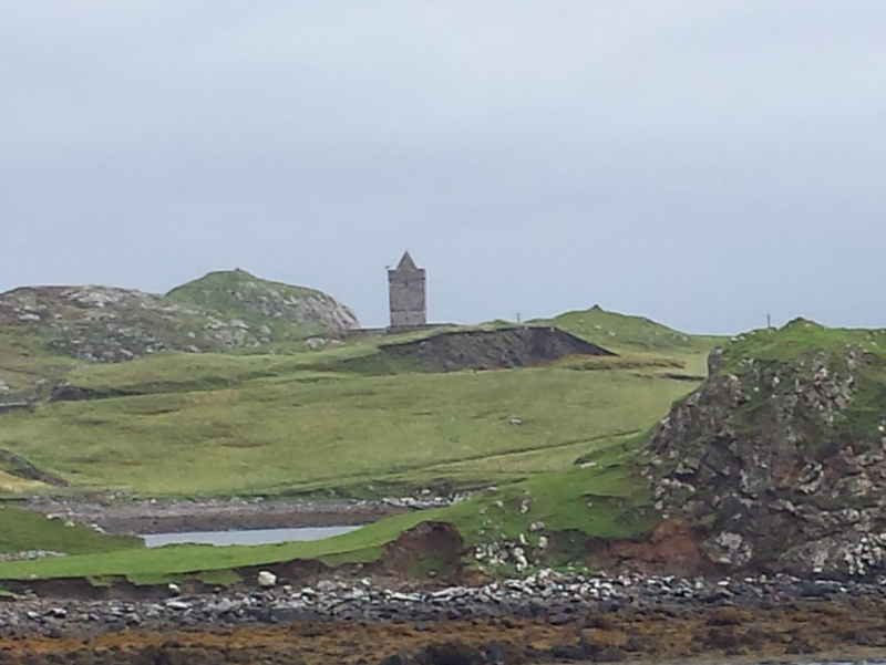
We made our first stop the visitor centre on Harris, and Melanie bought a book of Island walks. Book in hand, we drove to Port Eisgein, and walked from there to Renish Point. We saw the 16th Century St Clement’s Church from our starting point – a visually pleasing landmark. The walk itself was windy, wet, and boggy. The land is covered with greens, purples, and a lot of sheep droppings. Sheep poop aside, it was quite gorgeous, and the rain cleared up quickly for a slightly-less-wet walk back.
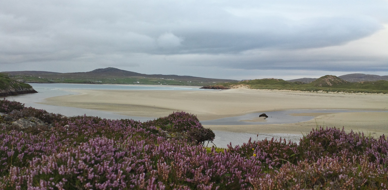
Melanie was keen to see some beaches, and we drove to a nearby one with an abandoned bus sitting on the sand. The water is turquoise, and if it hadn’t been ridiculously cold and windy, I could have sworn it was a beach in the Caribbean. Despite living five minutes from the
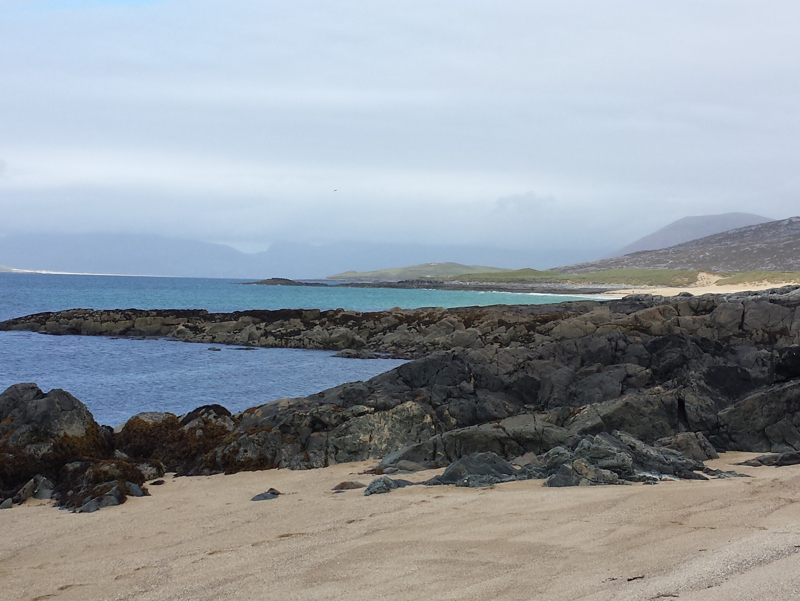
beach in Wollongong, it was still a real treat to see water that colour, surrounded by Scottish mountains.
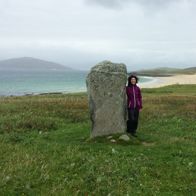
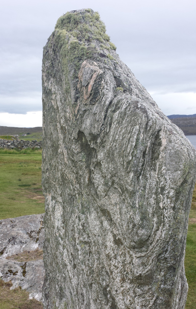
On the next beach, we found Clach Steineagaidh, a two-metre high standing stone. It felt very odd being next to something so old and culturally significant. The stone is estimated to be from the Neolithic or Early Bronze ages. Outlander fans, I didn’t hear any strange noises, nor did I manage any form of time travel. I did take a fair few photos, and relished the opportunity to explore more than just the shorelines.
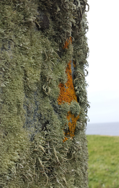
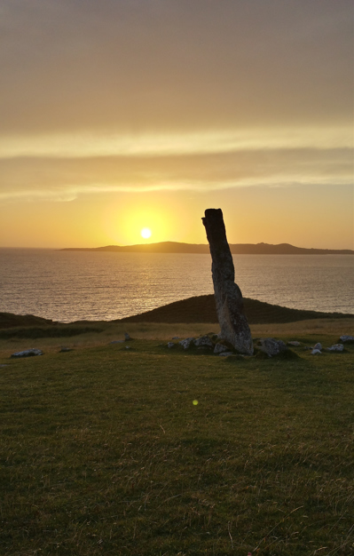
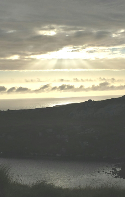
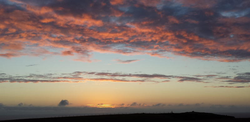
In the evening we headed to Traigh Iar beach, walking North to Clach Mhic Leoid; MacLeod’s Stone. It was covered in a coarse green plant, a lichen perhaps? Only a short distance across the beach and up the hill, we decided to stay until sunset. The colours of the sunset over the ocean in Harris were rich, and breathtaking. No photo could really capture the vast array of pinks, purples, apricots and oranges. We were freezing cold, and in utter awe of nature. Overlooking both the standing stone and the ocean, the sky turned red, the ocean turned a deep blue, and it felt like time moved at half pace.
In the morning we awoke to sunshine, with great relief. The air was chilled but there seemed no immediate threat of rain. Weather in the Hebrides can change in an instant, so our backpacks carry layers from t-shirts, to fleece and waterproofs.
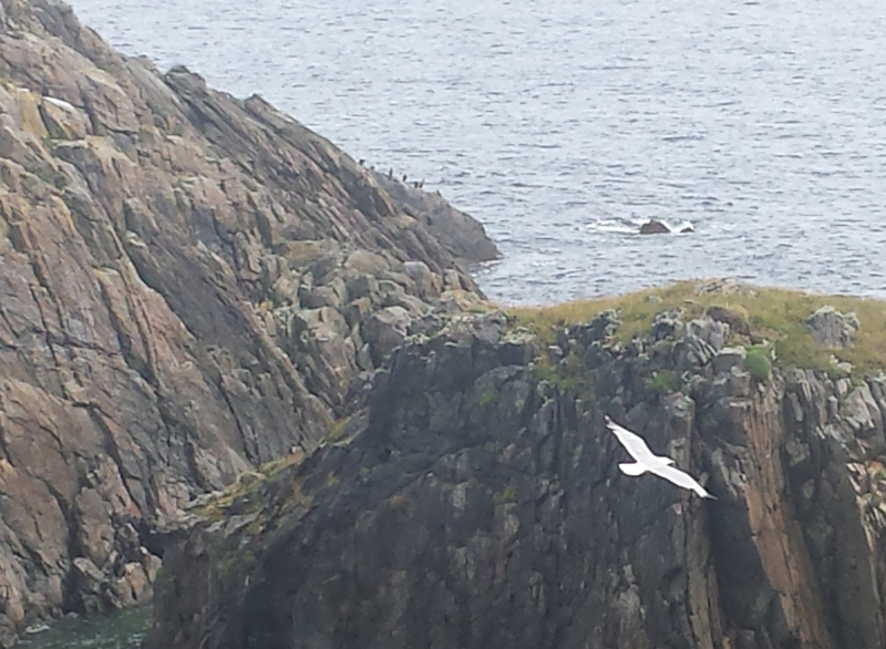
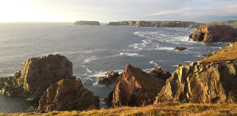
After a quick stop in Stornoway, we drove up to the Butt of Lewis. The name is quite deceptive, being that the Butt is the most northerly point on the island. It also made the Guinness World Book of Records for being the most windy.
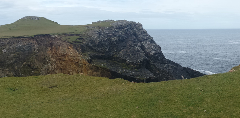
At the Butt of Lewis, rocky cliff faces with cavernous openings line the coast, topped with grassy hills, green covered rocks, overlooking miles of clear, calm ocean. Many visitors brought binoculars to see basking sharks or large birds. We stayed only a short while, before heading back to Stornoway. I wanted to explore the town, but again, time was limited. The area is well known for arts and crafts, and I’d love to have visited more galleries. We had a hot chip lunch, and a super quick walk around. I was able to see some of the local
sculptures before we moved on to Callanish.
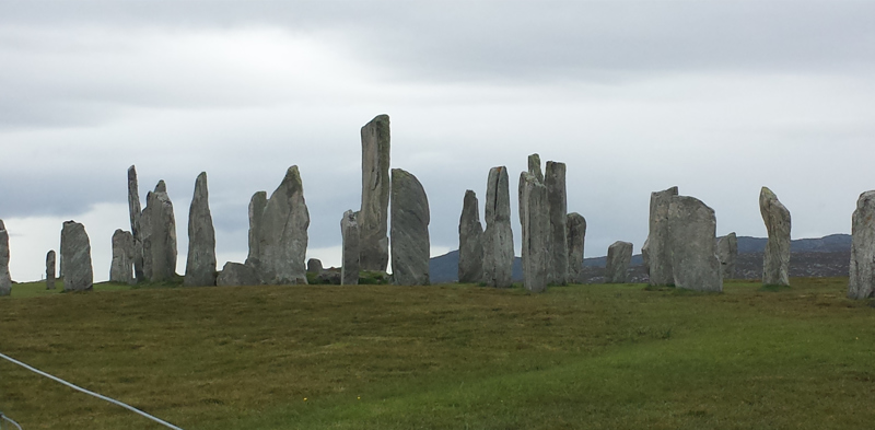
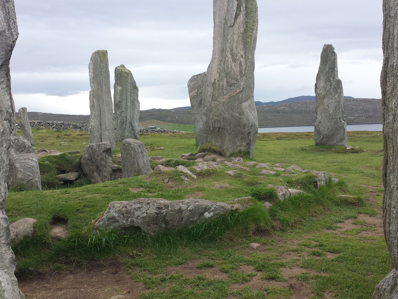
The standing stones of Callainais are an incredible sight. Forming the shape of a cross, there is a burial cairn in the centre. The size is impressive. That these stones would have been brought with manpower, speaks of the determination of people at the time. There are several theories about the use of the stones. They range from pagan rituals, meeting places, astrology points, prophecies of the coming of Christianity (almost a thousand years later), or a place for burials and marriage ceremonies. The land originally would have been fertile, and the temperature much warmer.
There are two other stone circles nearby Callanais, known as Callanis II and Callanais III. We had an easy access by path, but found so many cow pats, midges and mud, that we decided to leave soon after.
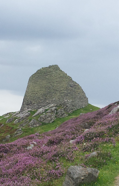
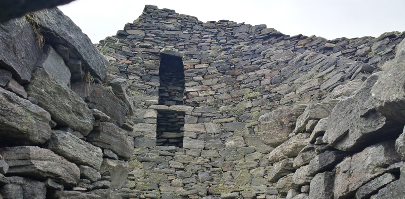
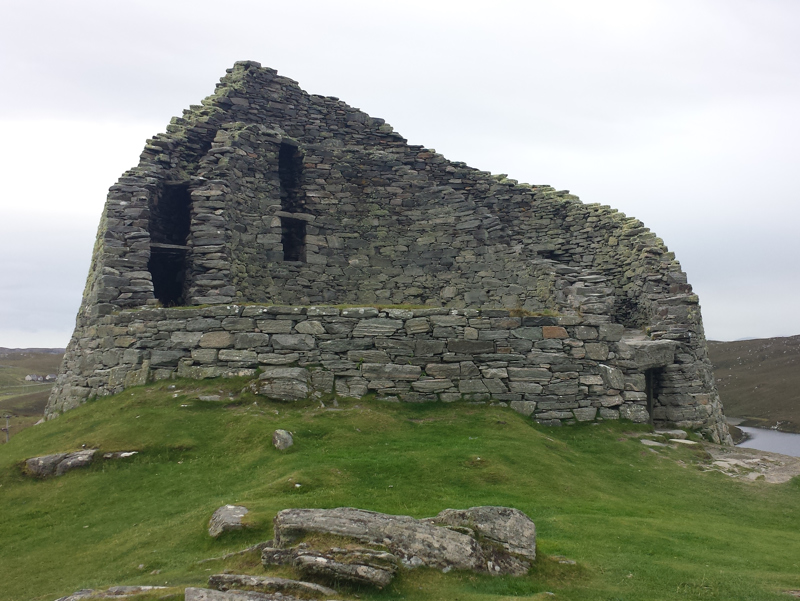
By my request, we travelled next to the Dun Carloway broch. This iron age house was amazing! Originally a three level, egg shaped abode, the entrances were so small even I was too tall to walk through. I crawled into some of the larger doorways, and climbed stairs to the second level, which no longer exists. The stones looked different to most on the island, almost like slate. To think that people lived here so many hundreds of years ago, and here I was playing in their kitchen like a child. The broch is thought to have been home to families, and given my experience, I would seem like a giant to them, at all of 5’2”.
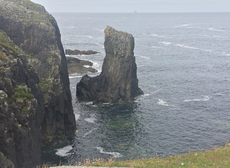
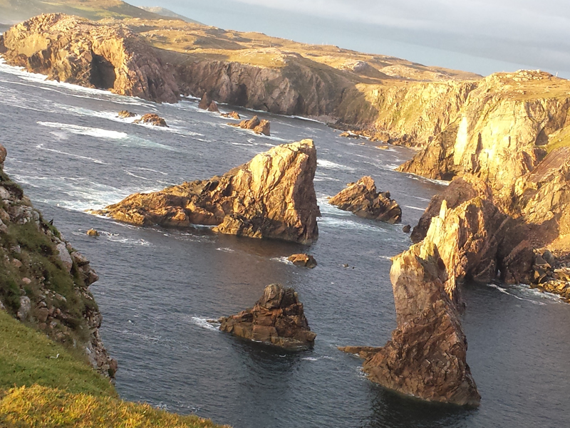
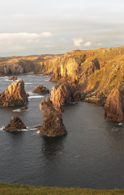
Melanie had been told about a coastal place, her friend called “the needles”. We didn’t have an official place for them on the map, but between her friend’s map and messages, we found ourselves driving through a green crater near Tolsta, surrounded by grass and purple covered hills. We parked on the side of the road, and crossed a strange, flat plane, covered with grass and rocks, and could have been
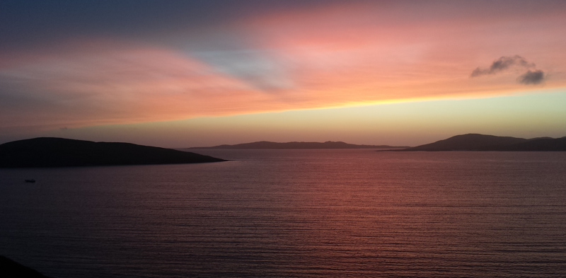
the moon in a child’s colouring in book. We found the cliff edges, and looked over to see “the needles”. These are a series of sharp, pointed rocks, protruding from the ocean, and completely surrounded by sheer drop cliffs. They’re not unlike the Twelve Apostles of Victoria, but a different shape. By luck of timing, we arrived as the sun was beginning to set. Behind us, the ocean glimmered and the sky turned colour. In front of us, low clouds hung over the mountains beyond the needles. Suddenly, a rainbow appeared. The spectrum twice over in its width, it was truly not possible to capture on my little Samsung phone. We were like children, jumping up and down with excitement. Scotland, I thought, you’ve outdone yourself. A perfect ending to an exciting and beautiful day.
1.
The First Step
2.
The 24 hour jump
3.
12 & 13th July
4.
15th - 17th July
5.
19th & 20th July
6.
21st & 22nd July
7.
23rd - 25th July
8.
27th July
9.
29th & 30th July
10.
July 31st - August 3rd
11.
4th & 5th August
12.
6th & 7th August
13.
9th & 10th August
14.
11th - 13th August
15.
14th & 15th August
16.
16th & 17th August
17.
18th & 19th August
18.
20th & 21st August
19.
22nd & 23rd August
20.
24th & 25th August
21.
26th & 27th August
22.
28th & 29th August
23.
30th August - 21st September
24.
Part II
25.
26th - 30th September
26.
1st - 6th October
27.
7th - 12th October
28.
14th - 16th October
29.
17th & 18th October
30.
19th - 20th October
31.
21st - 24th October
32.
25th - 27th October
33.
29th - 31st October
34.
1st - 10th November
35.
11th - 16th November
36.
Homecoming
Share your travel adventures like this!
Create your own travel blog in one step
Share with friends and family to follow your journey
Easy set up, no technical knowledge needed and unlimited storage!