
Mem's Journey to Scotland
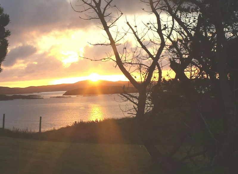
We were staying on the Eastern side of the islands, and the sun was rising over the ocean as we emerged from our tent. Our drive home the previous night had been almost two hours, given that we were coming from the North West to the South East, and no road crossed the island in an Easterly direction. We packed up quickly, our tent base now covered in mud and sheep droppings. We arrived at the ferry port for low tide. Boats we passed on the lakes had been floating the previous day, and were now sitting on the lake beds, surrounded by those small islands which made the boats appear as if they were in a sandy crater.
We took the ferry to North Uist, befriending a couple of local men on the way. As we drove to the campsite an hour after disembarking, one of the men passed us in the opposite direction. He’d seen us with the map (and German car) and pulled over to make sure we were okay.
The campsite was windy, and after our previous experience, we found several large rocks to ensure our tent stayed up. Tent safe, we drove up the coast towards Berneray.
We stopped on the way to view the Cille Phead Cross from a distance, and then
Mem Davis
36 chapters
16 Apr 2020
24th & 25th August
August 25, 2016
|
Isles of Lewis & Harris
We were staying on the Eastern side of the islands, and the sun was rising over the ocean as we emerged from our tent. Our drive home the previous night had been almost two hours, given that we were coming from the North West to the South East, and no road crossed the island in an Easterly direction. We packed up quickly, our tent base now covered in mud and sheep droppings. We arrived at the ferry port for low tide. Boats we passed on the lakes had been floating the previous day, and were now sitting on the lake beds, surrounded by those small islands which made the boats appear as if they were in a sandy crater.
We took the ferry to North Uist, befriending a couple of local men on the way. As we drove to the campsite an hour after disembarking, one of the men passed us in the opposite direction. He’d seen us with the map (and German car) and pulled over to make sure we were okay.
The campsite was windy, and after our previous experience, we found several large rocks to ensure our tent stayed up. Tent safe, we drove up the coast towards Berneray.
We stopped on the way to view the Cille Phead Cross from a distance, and then
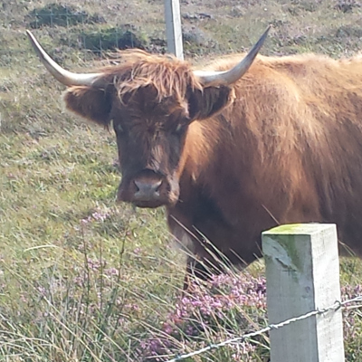
Scolpaig tower; a tiny, squat tower, on a tiny island, in the middle of a lake. We were unable to walk to the castle, as it sits on private land. We created a theory that the farmer hides in the miniature castle, shooting arrows through the tiny slots at any trespassers. It was a fun theory, quickly forgotten by me when we met some Highland cows en route to Berneray. They’re beautiful, shaggy-fringed creatures, who looked up at me with some mild curiousity, before returning to their grass munching. Apparently I’m not a threat, as they didn’t seem to mind one excited woman taking zoomed in photographs.
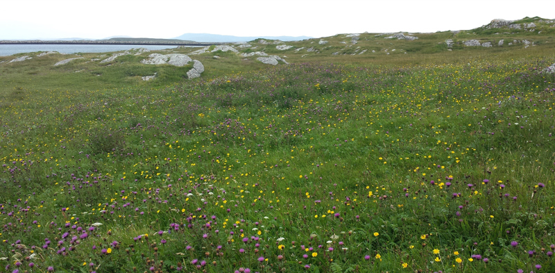
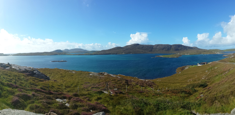
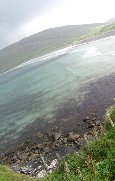
We found the shoreline, and the colours were incredibly beautiful. I seem to be on repeat about the coasts of the Outer Hebrides, but there was an ocean of turquoise and royal blue, bright green grass and rocks. The wind was relentless, but the brightness made it worth the visit.
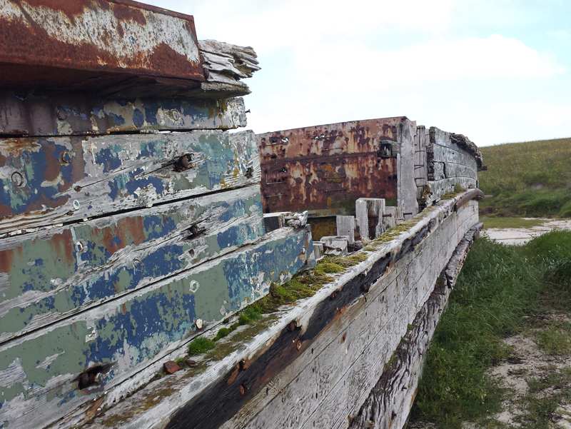
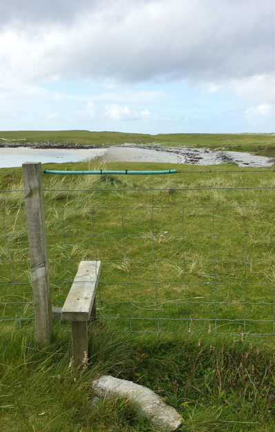
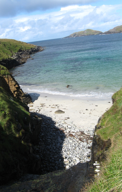
The coastal walk in Berneray saw us through fields dotted with purple knotweed, thistle, buttercups and dandelions. It was like walking through a Monet painting. We went through a loch at low tide (with all the smells that come with a low tide), and found an old, abandoned boat. The textures and faded timbers were lovely to explore. From here, the loch met the ocean, and we walked across a long beach. The beach was completely covered in stones and pebbles.
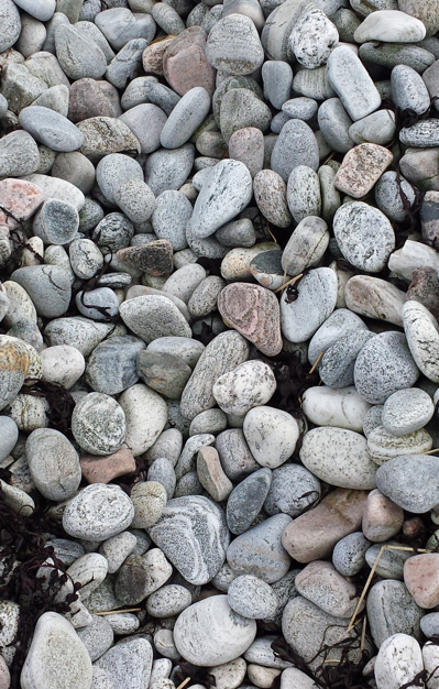
Smooth, oval shapes, with different patterns, and colours ranging from pinks, to whites and greys. We passed a remembrance cairn for Angus MacAskill, a seven-foot giant of a man. As we headed home, another rainbow appeared, because Scotland seems to be some magical place where rainbows appear. No unicorn sightings yet.
We returned to the car completely windswept, but having been treated to almost two hours of visual pleasure, it didn’t hugely matter.
The campsite, on our return, was quiet. We paid £1 for a seven-and-a-half-minute shower. We both agreed that it was the best shower we’d had since leaving Edinburgh: clean, warm, and free of midges. The luxury was most appreciated, especially as my body was starting to feel the effects of eating cheap food on the run. Too much bread, not enough fruit and vegetables, and I was starting to bloat and cramp. With five days to go until our return, I decided to make a concerted effort to eat better, somehow. There’d been no running that week either, with our days starting around six am, and not arriving back at the campsite until late. Camping itself was getting easier, with our set ups and pack-downs becoming faster. I wouldn't go calling myself an expert, but it's definitely been a learning experience, especially sleeping on a sloping site.
The next day, the rain woke us up just before six. I wandered up to the kitchen, and found a newspaper article about a crofter who had found a nesting bird on his field. He carefully dug up the nest and soil, ploughed the field, and returned the nest to its original position. The bird and her eggs were quite safe, and he was quoted as saying it was a crofter tradition to do so, as his father and grandfather had done the same. It’s nice to know there are people who care about more than just their pockets, and take the time to care for other animals too.
Our goal for the day was to explore South Uist, with our first detour being to Fionn’s People. This was something we’d found drawn on our local map, and decided it sounded interesting enough to visit. Our first problem arose when we realised that the map differed greatly from real life. There was no signage, no hint of a place, building, or ruin by that name. Instead we detoured to a local pottery shed I’d been longing to see, but it was closed. We followed a sign to a sculpture, one of a series on the islands. After several turns to see the sculpture (which was very well signposted), we arrived at a dead end, and a sign which stood declaring the “sculpture”. Which was a blue, tiled bench. The anti-climax was forgotten when Melanie stepped in fresh cow pat, and I watched her dance an Elvis-like jig trying to get it off her shoe.
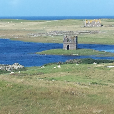
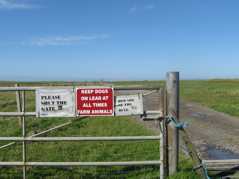
Giving up on detours, we headed straight for Tobha Mor, where there is a series of ancient chapels, indicating the presence of Christianity in the 9th Century. The exact date of the buildings is unknown. We found the sign for the chapels, but couldn’t see the buildings, and walked instead for a pleasant hour along the beach. We saw the chapel ruins on our drive back, and continued on to Rubha Aird a’Muile. Here we walked for two hours, starting with an information sign about the Viking history of the place. Shortly after the beginning of the walk, we saw a sign saying “beware of the bull”. We’d already met several cows, and didn’t think the bull would roam free the same way the cows did, when walking paths led directly through the fields. We were wrong. Just before the first turn, there was a large, black animal staring us down. We couldn’t tell from the distance whether it was male or female, and although I couldn’t see any horns, we walked the long way around the field just in case.
The path took us up a hill, where we had a 360-degree view of the island. We continued to the most Westerly point of South Uist,
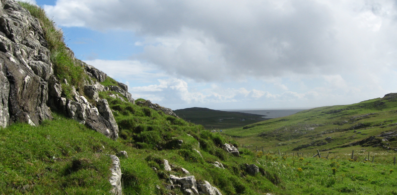
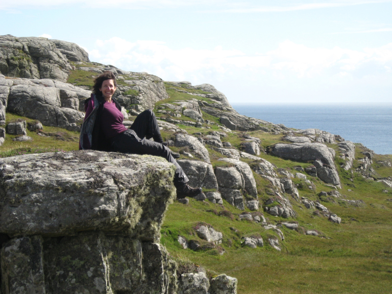
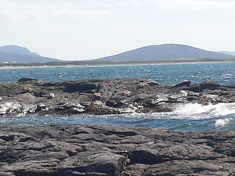
passing the ruins of an Iron Age tower along the way. We didn’t see any sign of Vikings, but at a rocky outcrop just near the Westerly point, we found a group of seals! Melanie crept across the rocks, to about five hundred metres away, and took some photos. My approach was a little more clumsy, and unfortunately I scared them a little, and so we retreated. I stood watching the seals from a distance, while Melanie watched the crashing waves. There were a couple of seals swimming close by, spotted by Melanie’s quick eyes.
On the other side of the point, a loch meets the ocean. From salt to freshwater, and seals to swans, we found a family of beautiful birds coasting along in the lake below us. All within less than a kilometre.
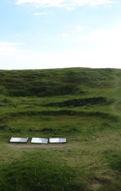
Stop three for the day was the Cladh Hallan Roundhouses. This is where some mummified skeletons had been discovered. This walk took us along yet another beach, and we cut it short.
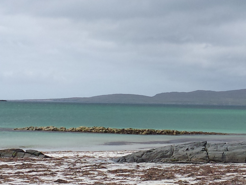
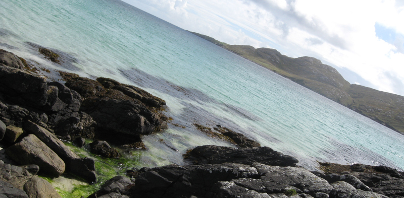
The road back North was just as attractive, with some of the clearest, bluest water I’ve ever seen.
We finally returned to Shoreline Stoneware, owned by a local ceramics artist. The artist uses natural substances found on the island to enhance her work. Some dishes contain dried grasses, woven around the edge. Others contain beach glass, sands and clays, to created watery or landscape-like images across the surface. Her work is truly reflective of the island she lives on, and I was so glad to meet such a talented artist.
1.
The First Step
2.
The 24 hour jump
3.
12 & 13th July
4.
15th - 17th July
5.
19th & 20th July
6.
21st & 22nd July
7.
23rd - 25th July
8.
27th July
9.
29th & 30th July
10.
July 31st - August 3rd
11.
4th & 5th August
12.
6th & 7th August
13.
9th & 10th August
14.
11th - 13th August
15.
14th & 15th August
16.
16th & 17th August
17.
18th & 19th August
18.
20th & 21st August
19.
22nd & 23rd August
20.
24th & 25th August
21.
26th & 27th August
22.
28th & 29th August
23.
30th August - 21st September
24.
Part II
25.
26th - 30th September
26.
1st - 6th October
27.
7th - 12th October
28.
14th - 16th October
29.
17th & 18th October
30.
19th - 20th October
31.
21st - 24th October
32.
25th - 27th October
33.
29th - 31st October
34.
1st - 10th November
35.
11th - 16th November
36.
Homecoming
Share your travel adventures like this!
Create your own travel blog in one step
Share with friends and family to follow your journey
Easy set up, no technical knowledge needed and unlimited storage!