
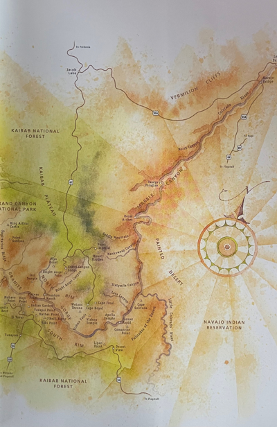
USA AMTRAK RAIL TRIP GRAND CANYON
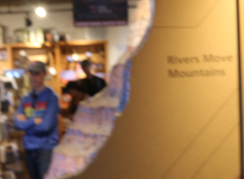
The Yavapai Museum of Geology , Yavapai Geology Museum or Yavapai Geology Museum , is an American museum in Coconino County , Arizona . Located within Grand Canyon National Park , it is dedicated by the National Park Service to introducing its visitors to the geology of the canyon.
The Geotourism Museum occupies a building constructed in 1928 to serve as a vantage point of the Grand Canyon , which it overlooks from its southern edge, the South Rim. Built in the rustic style of the National Park Service , it was originally considered a trailside
salahudin Ghafoor
10 chapters
21 Jan 2022
CHAPTER 3
June 21, 2018
|
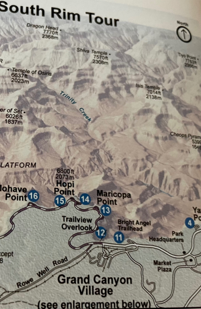
YAVAPAI GEOLOGY MUSEUM
The Yavapai Museum of Geology , Yavapai Geology Museum or Yavapai Geology Museum , is an American museum in Coconino County , Arizona . Located within Grand Canyon National Park , it is dedicated by the National Park Service to introducing its visitors to the geology of the canyon.
The Geotourism Museum occupies a building constructed in 1928 to serve as a vantage point of the Grand Canyon , which it overlooks from its southern edge, the South Rim. Built in the rustic style of the National Park Service , it was originally considered a trailside
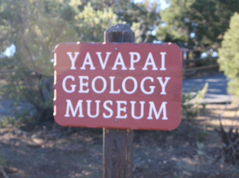

museum and was first called Yavapai Point Trailside Museum and then
Yavapai Observation Station.
GEOLOGY OF THE GRAND CANYON (WIKAPAEDIA)
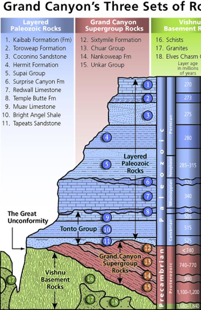
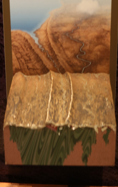
Diagram showing the placement, age and thickness of the rock units exposed in the Grand Canyon
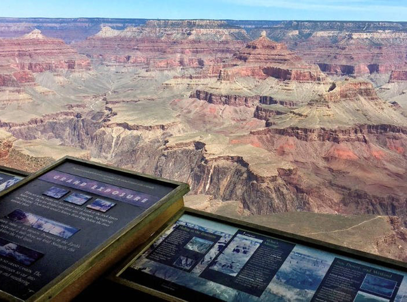
Rockfalls in recent times, along with other mass wasting, have further widened the canyon
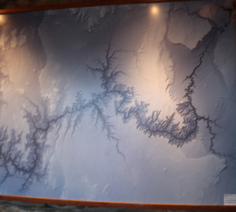
The Grand Canyon is part of the Colorado River basin which has developed over the past 70 million years,[16] in part based on apatite (U-Th)/He thermochronometry showing that Grand Canyon reached a depth near to the modern depth by 20 Ma.[17] A recent study examining caves near Grand Canyon places their origins beginning about 17 million years ago. Previous estimates had placed the age of the canyon at 5–6 million years.[18] The study, which was published in the journal Science in 2008, used uranium-lead dating to analyze calcite deposits found on the walls of nine caves throughout the canyon.[19] There is a substantial amount of controversy because this research suggests such a substantial departure from prior widely supported scientific consensus.[20] In December 2012, a study published in the journal Science claimed new tests had suggested the Grand Canyon could be as old as 70 million years.[21][22] However, this study has been criticized by those who support the "young canyon" age of around six million years as "[an] attempt to push the interpretation of their new data to their limits without consideration of the whole range of other geologic data sets."[18]
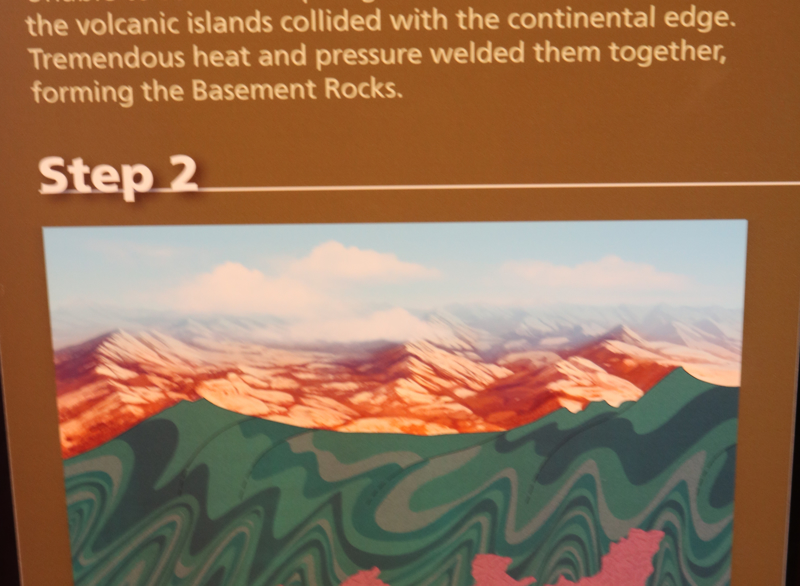
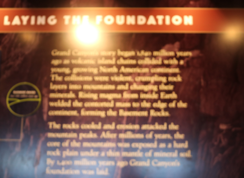
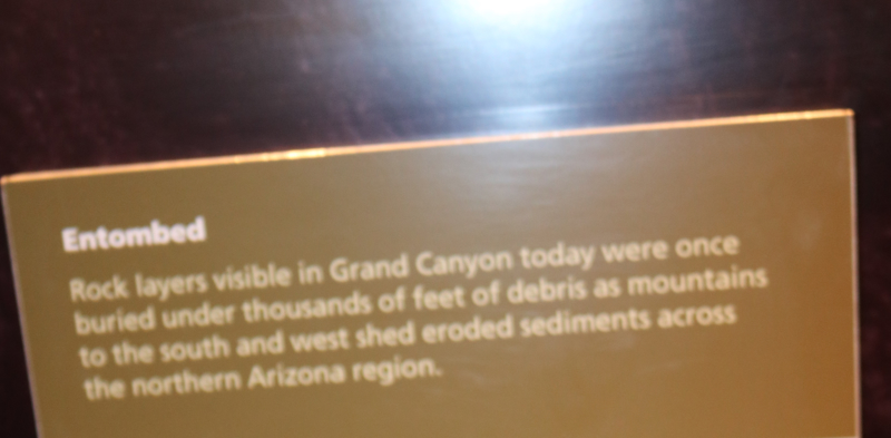
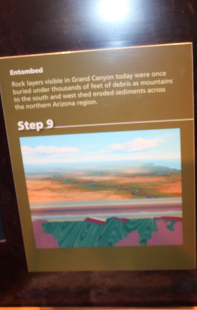
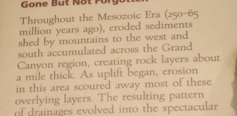
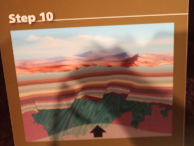
The canyon is the result of erosion which exposes one of the most complete geologic columns on the planet.
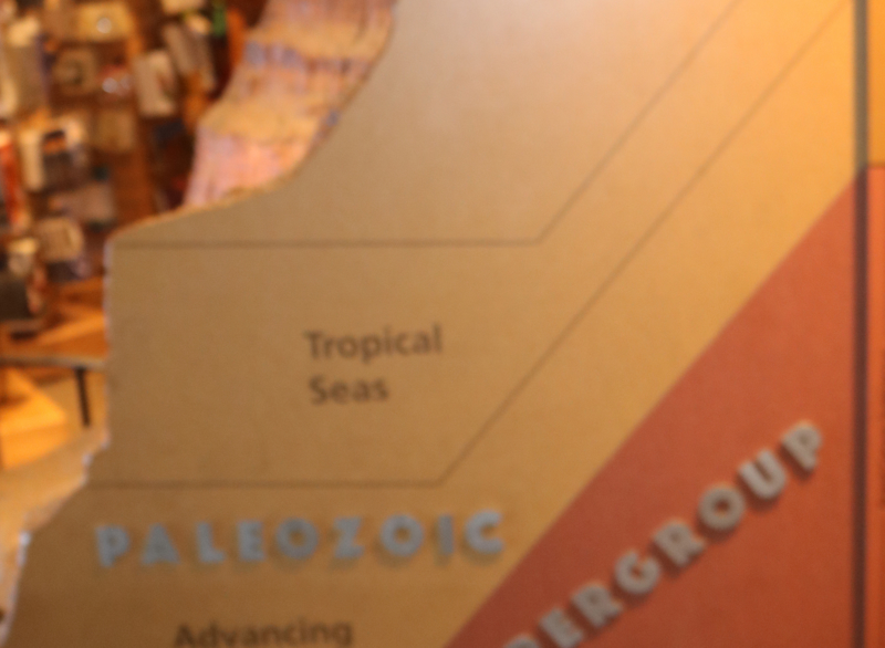
The major geologic exposures in the Grand Canyon range in age from the 2-billion-year-old Vishnu Schist at the bottom of the Inner Gorge to the 270-million-year-old Kaibab Limestone on the Rim. There is a gap of about a billion years between the 500-million-year-old stratum and the level below it, which dates to about 1.5 billion years ago. This large unconformity indicates a long period for which no deposits are present.
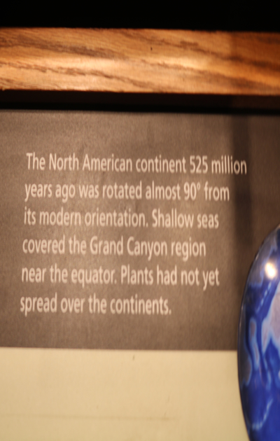
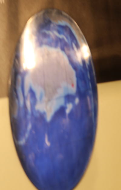
Many of the formations were deposited in warm shallow seas, near-shore environments (such as beaches), and swamps as the seashore repeatedly advanced and retreated over the edge of a proto-North America. Major exceptions include the Permian Coconino Sandstone, which contains abundant geological evidence of aeolian sand dune deposition. Several parts of the Supai Group also were deposited in non–marine environments.
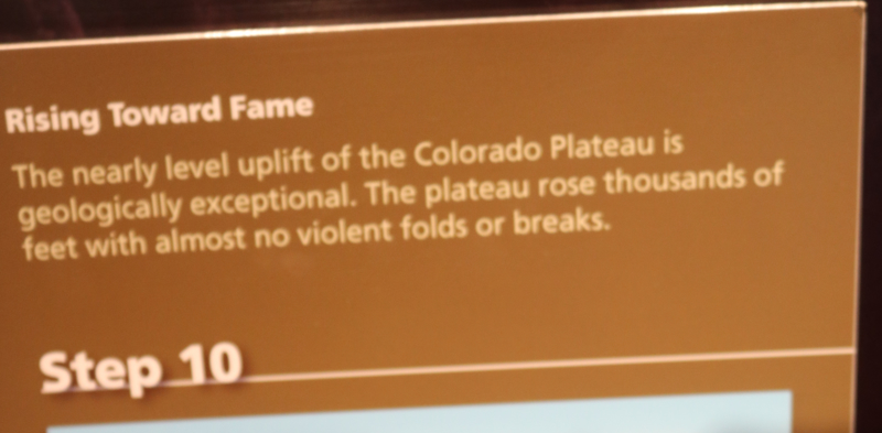
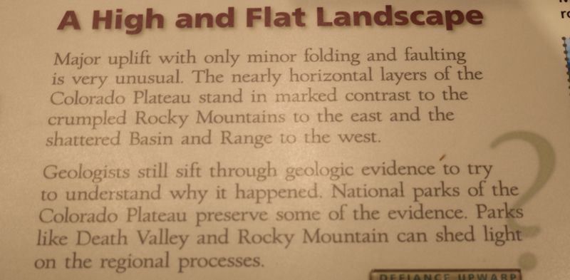
The great depth of the Grand Canyon and especially the height of its strata (most of which formed below sea level) can be attributed to 5–10 thousand feet (1,500 to 3,000 m) of uplift of the Colorado Plateau, starting about 65 million years ago (during the Laramide Orogeny). This uplift has steepened the stream gradient of the Colorado River and its tributaries, which in turn has increased their speed and thus their ability to cut through rock (see the elevation summary of the Colorado River for present conditions).
Weather conditions during the ice ages also increased the amount of water in the Colorado River drainage system. The ancestral Colorado River responded by cutting its channel faster and deeper.
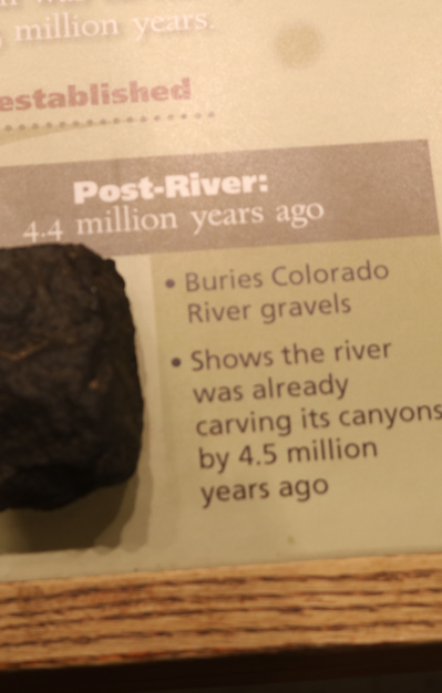
The base level and course of the Colorado River (or its ancestral equivalent) changed 5.3 million years ago when the Gulf of California opened and lowered the river's base level (its lowest point). This increased the rate of erosion and cut nearly all of the Grand Canyon's current depth by 1.2 million years ago. The terraced walls of the canyon were created by differential erosion.[23]
Between 100,000 and 3 million years ago, volcanic activity deposited ash and lava over the area which at times completely obstructed the river. These volcanic rocks are the youngest in the canyon.


Share your travel adventures like this!
Create your own travel blog in one step
Share with friends and family to follow your journey
Easy set up, no technical knowledge needed and unlimited storage!