
The hiking paradise of Wallis: 7 amazing routes through the swiss mountains
The iconic Matterhorn adorning Toblerone boxes, the largest glacier in the Alps, and a turquoise reservoir behind one of Europe's largest dams. These extremes are just a few of the highlights in Wallis. Here are 7 hiking tips to discover this area.
Paulien van der Werf
Bordering Italy and France, the Swiss region of Wallis is home to 45 mountains that are over four thousand meters high, the largest glacier in the Alps, healing alpine flora, and many picturesque mountain villages. Wallis is therefore a true hiking paradise. Learn about glaciers on an educational glacier trail or venture out onto the Aletsch Glacier with a guide. Whether you're following old irrigation channels, winding mountain paths, or the shores of a reservoir, each landscape offers a unique experience.
1. Healing Alpine Flora
In the herb-rich alpine meadows between the impressive peaks of Wallis in the Dents du Midi region, you'll feel like you're in The Sound of Music. Birds chirping cheerfully, and wildflowers and herbs spreading a summery aroma. The plants and herbs have been used by locals for centuries in dishes and teas. Go hiking with a guide from one of the mountain villages and learn which plants have healing properties when used in balms or herbal teas.
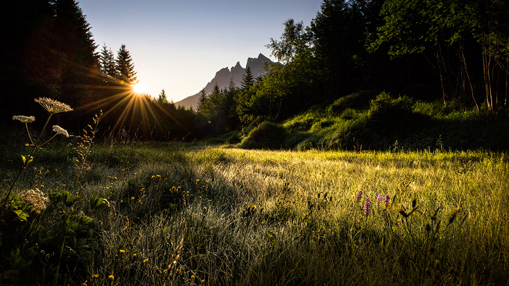
Photo: Région Dents du Midi/Litescapemedia
2. Educational Glacier Trail
Once, ice-blue glacier tongues reached deep into the valleys of Wallis. Today, half of the municipality of Saas-Fee, just north of the Italian border, is still covered by glaciers. Due to climate change, the glacier tongues are now higher above the valley. Walk over the former bed of a glacier on the educational glacier trail from the village of Saas-Fee. This one-and-a-half-hour hiking route provides insight into how glaciers shape the landscape and how they are affected by climate change.
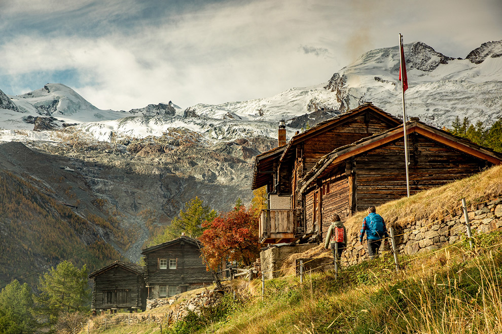
Photo: Saas Fee/Jan Geerk/Zwitserland Toerisme
3. Above and Across the Aletsch Glacier
You'll feel miniscule when you look out over the eleven billion tons of ice of the Aletsch Glacier. With a length of 23 kilometers and a thickness of up to nine hundred meters in some places, this is the largest glacier in the Alps. From the Panoramaweg at Bettmeralp in the northeast of Wallis, you get an idea of just how immense the ice mass is. Walk among the highest mountains of Wallis, including the Toblerone mountain Matterhorn. Have you always wanted to see what a glacier looks like up close? Under the guidance of a mountain guide, take a walk on the glistening icy surface of the glacier.
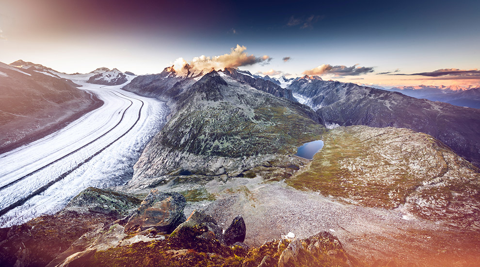
Photo: Aletschgletscher/Frederic Huber/Wallis Promotion
4. Along Old Irrigation Channels
A network of over a hundred kilometers of old irrigation channels directs water from the mountains to the dry land of the village of Nendaz, south of Sion. These "bisses" range from 700 to 2300 meters in altitude and collect water from rivers and glaciers. This system has been used for local agriculture for generations, making it an important part of local culture. Walk from Nendaz along car-free paths and bridges through a landscape that has remained unchanged for decades.
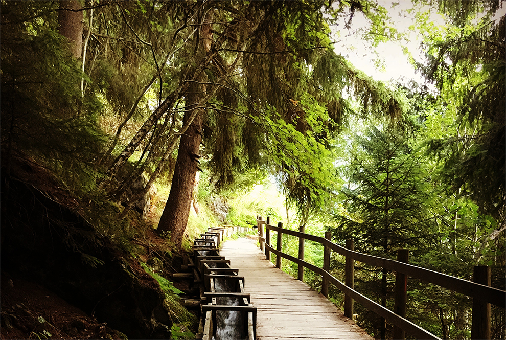
Photo: Veysonnaz/Veysonnaz Toerisme
5. Hike to the Lämmerenhütte
Surrounded by steep, barren rocks at 2,500 meters lies a wooden mountain hut overlooking mountains nearly four thousand meters high: the Lämmerenhütte. The hut is located on the Wildstrubel, a glacier-covered mountain ridge on the border between the regions of Wallis and Bern. Hike eight kilometers uphill from the village of Leukerbad, one of the most beautiful hiking routes in the area. After a long, steep climb, you'll be rewarded with panoramic views over a clear blue lake and the high Alps of Wallis. The Lämmerenhütte is run as sustainably as possible, minimizing packaging materials, environmentally friendly waste disposal, and purchasing locally produced products. Those looking out the window have a good chance of spotting marmots and ibexes. Panoramic mountain hiking trails begin at the hut leading to the mountain villages of Leukerbad, Kandersteg, and Adelboden.
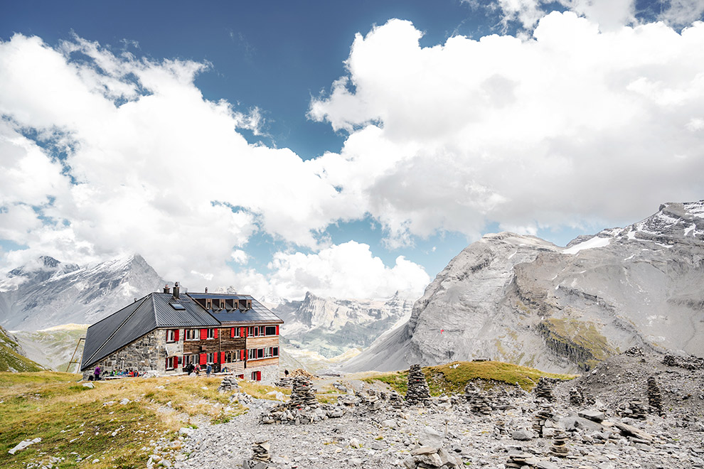
Photo: Leukerbad/Chrissie.st
6. The Dents du Midi Trail
Hike surrounded by towering mountains, green meadows, and crystal-clear lakes on the Dents du Midi Trail for two to four days. Over 42.5 kilometers, you'll loop from the village of Champéry on the eastern border of the canton around the Dents du Midi, a rugged peak in the Prealps near the French border. On the mountain trails, you'll often feel like you're alone in the world, enjoying ever-changing vistas. The over 6,000 meters of ascent and descent will challenge your legs, but fortunately, there are plenty of spots for a picnic with views of glaciers and high peaks. Stay in cozy mountain huts and enjoy a well-deserved meal as the mountain peaks stand as blue silhouettes against an orange sky.
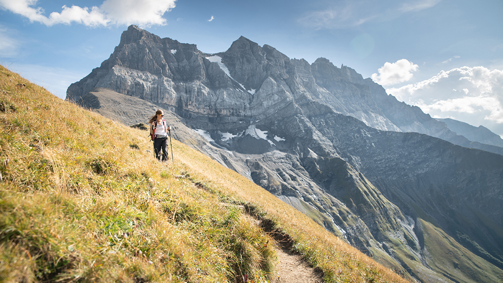
Photo: Dents du Midi/Julie Rebaudo/JB bieuville
7. Around the Mattmarksee
At the end of the Saastal valley, a long valley in the south including the village of Saas-Fee, lies a turquoise reservoir. The Mattmark Dam sits at 2.2 kilometers altitude and holds up to 100 million cubic meters of water. Thanks to this reservoir, the hydroelectric power plant in the valley can generate enough electricity to power every household in Wallis. Learn more about this sustainable method of energy generation at the visitor center on the dam. Hike a circular route of eight kilometers around the lake to enjoy the impressive mountains rising from the shores.
Tip: Rent an E-bike in Saas-Fee and cycle to the lake via Saas-Almagell.
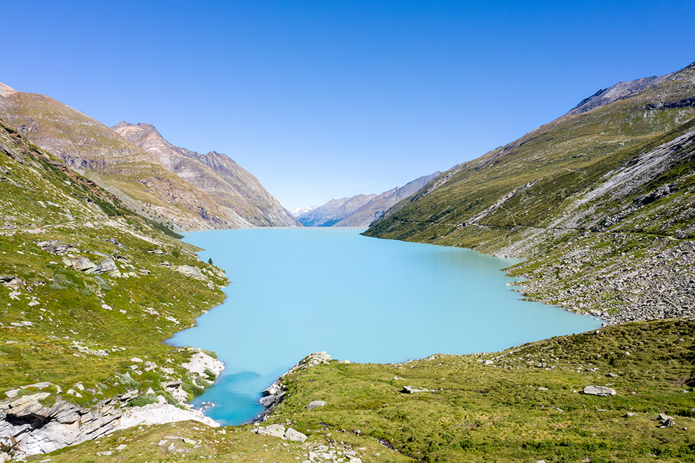
Photo: Mattmark dam/Saastal Tourismus AG
Exploring Wallis Further
Discover the mountains and villages of Western Wallis from behind the panoramic windows of the Mont Blanc Express. This train runs along the mountainsides from the city of Martigny through various villages in Wallis and eventually into France. This train route is among the most beautiful in Europe and takes you to places inaccessible by car. Among the highlights in Wallis is the Stockalper Castle, a fairy-tale castle from 1651 located in Brig, in the northern part of the canton. Inside the castle, you'll learn about the life of Mr. Stockalper; a merchant, banker, military man, and politician who was called the "King of the Simplon" thanks to his success.
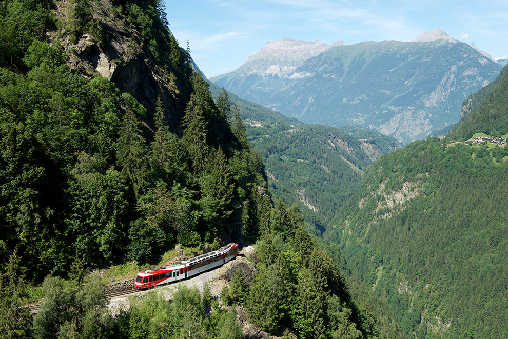
Photo: Mont-Blanc Express/Francois Perraudin/Fascination Alpes Sarl
In the south, visit Zooom the Matterhorn, an exhibition on the 3089-meter-high Gornergrat mountain ridge. Here, you'll learn all about the local flora and fauna and, thanks to virtual reality goggles, experience what the different seasons look like in this area. With a 3D headset on, you'll experience a paragliding flight above the snow-capped peaks of Zermatt from the comfort of your chair.
Interested in learning more about sustainable adventures in Switzerland? Check out these tips for other sustainable vacations in Switzerland.
Create your own blog
Easily add stories to your diary in our online editor or app
Add your images and choose your pages layouts
Share your journey in real time without the fuss!

