Ontario - Thunderbay
Thunderbay Adventures, 09.17.2018
Today is our last day to enjoy the sights of ThunderBay and Loon Lake. Wanting to spend a little more time with Barry and Janice, we got up and headed over for coffee first thing in the morning. With Roxy in tow we headed out for a walk around Loon Lake to explore their 250+ acres of land they own in and around the lake. They have been moving and reshaping the land for about 7 years to put in a road that meanders around to access 2 - 100 ft lake front properties. They have been reshaping the land to prevent flooding from the local stream, as well as, clearing shrub and bushes to create a proper roadway into the the lake lots. The plan is to build a new house on
this section of land sometime down the road. What a fun project.
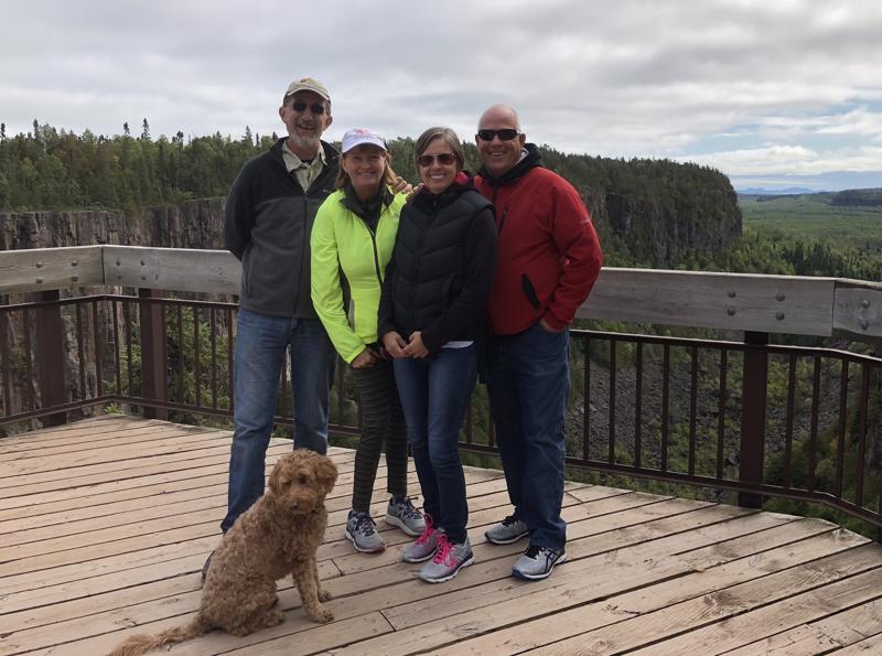
After coffee we headed back to Holly and Duffs for a bit of a visit before we headed out to do some more exploring of the vast wilderness of the area. We headed out for some light hiking/walking of the Ouimet Canyon.
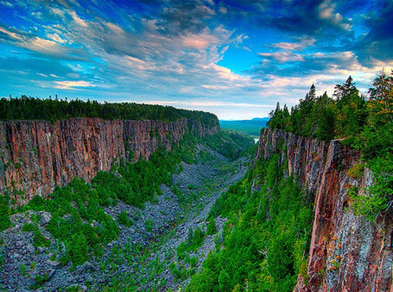
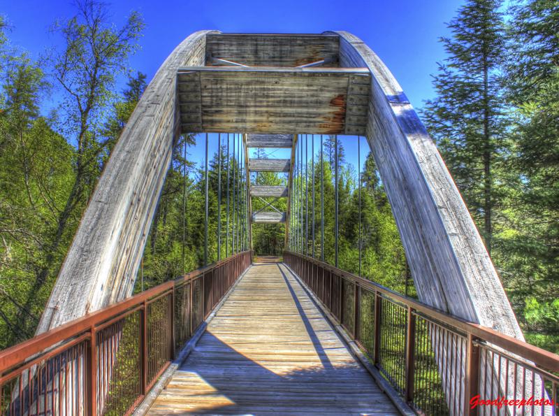
A gravel road leads north off the highway 12 km to the spectacular Ouimet Canyon. A vertical joint (fissure) in the rock has been eroded over many centuries to a depth of 107 m and a width of 152m. Rocks fallen from the vertical sides have accumulated at the bottom, which is protected from the warm summertime air of; to create an Arctic micro-climate that allows several arctic plant species to thrive.vA trail and boardwalk connects two lookout platforms with spectacular views of the canyon. Absolutely breathtaking.
We did consider going to the Sleeping Giant for some more hiking, but with the heavy winds and cool breeze we thought that we would take a miss on that one this trip.
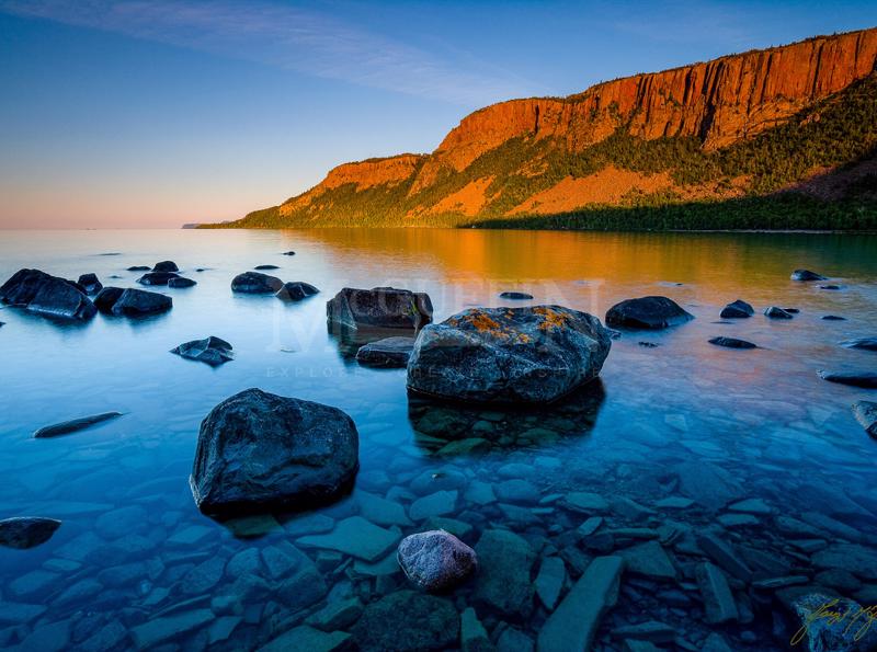
I had no idea that ThunderBay and area was so spectacular. To have such amazing provincial parks and green space not only right in the city, but to have camping, hiking and other outdoor adventures right out your backyard is pretty spectacular. You can paddle board, Kayak, sail, hike, mountain bike, country ski, downhill ski, snowshoe and even rock and ice climbing all within 30 mins of ThunderBay. The hills/mountain is very small, but the vast wildness surrounding ThunderBay makes up for it. A person could spend weeks exploring the area and never see anything twice. Truly an outdoor enthusiasts playground.
After a day of exploring Duff and Holly hosted the gang for a BBQ dinner. A feast of ribs, chicken, steak, greek salad, potatoes and dessert was enjoyed by all. It is likely the last time for a long time that the group of 10 will be getting together for dinner. Rick will be heading down to DR this winter for 3.5 weeks and will be joining the gang without me.
We have really enjoyed our time in ThunderBay and hope that we can make it out east again to see everyone. Everyone is always welcome at our house if they happen to head out west! Tomorrow we continue on in our journey towards Toronto to spend time with Jay, Katie and the boys.
Interesting facts about Lake Superior:
1. Lake Superior is, by surface area, the world's largest freshwater
lake.
2. The surface area of Lake Superior (31,700 square miles or 82,170 square kilometers) is greater than the combined areas of Vermont, Massachusetts, Rhode Island, Connecticut, and New Hampshire.
3. Lake Superior contains as much water as all the other Great Lakes combined, even throwing in two extra Lake Eries. Its volume is second only to Russia's Lake Baikal.
4. Lake Superior contains 10% of all the earth's fresh surface water.
5. There is enough water in Lake Superior to flood all of North and South America to a depth of one foot.
6. The deepest point in Lake Superior (about 40 miles north of Munising, Michigan) is 1,300 feet (400 meters) below the surface.
7. Over 300 streams and rivers empty into Lake Superior.
8, The average elevation of Lake Superior is about 602 feet above sea level.
9. The Lake Superior watershed region ranges in size from 160 miles inland near Wabakimi Provincial Park to only 5 miles inland from Pictured Rocks National Seashore.
10. The Lake Superior shoreline, if straightened out, could connect Duluth and the Bahama Islands.
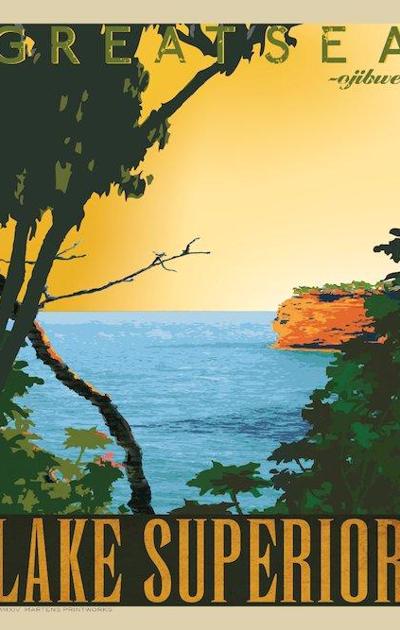
11. The average underwater visibility of Lake Superior is 27 feet, making it easily the cleanest and clearest of the Great Lakes. Underwater visibility in places reaches 100 feet. Lake Superior has been described as "the most oligotrophic lake in the world."
12. The lake is about 350 miles (563 km) in length and 160 miles (257 km) in width.
13. In the summer, the sun sets more than 35 minutes later on the western shore of Lake Superior than at its southeastern edge.
14. Lake Superior has over 400 islands, the largest of which is Isle Royale, with a size of 207 square miles.
15. Waves of over 40 feet in height have been recorded on Lake Superior.
16. Travel by car around Lake Superior covers a distance of about 1,300 miles.
17. The largest underwater formation in Lake Superior is the Superior Shoal, which rises from a depth of over 1,000 feet to within 20 feet of the water surface over a distance of just three miles.
18. Sudden changes in winds or barometric pressure around Lake Superior can produce seiches, a phenomenon which results in water levels rising or falling as much as six feet along a coast in a short period of time.
 Web
Web Android
 iOS
iOS